
Captain Marie Dubois still remembers the phone call that changed everything. It was 2018, and she was piloting a cargo ship through the notoriously tricky waters off Brittany when her GPS suddenly failed. The fog was thick, visibility near zero, and her multi-million-dollar vessel was carrying 20,000 tons of electronics bound for Hamburg.
“Without the French nautical charts, we would have been sailing blind,” she recalls. “Those detailed depth measurements and hazard markers saved my ship and crew that night.”
What Captain Dubois didn’t know was that those life-saving charts came from an institution most people have never heard of – one that’s been quietly keeping ships safe for over three centuries.
France’s Best-Kept Maritime Secret
While Britain often gets credit as the world’s maritime superpower, France has been running circles around them in one crucial area for 305 years. The French hydrographic service, known as SHOM (Service hydrographique et océanographique de la Marine), was founded in 1720 – a full 75 years before the UK Hydrographic Office even existed.
This isn’t just a historical footnote. The French hydrographic service continues to operate as the world’s oldest continuously running ocean mapping organization, quietly dominating a field that most people don’t even know exists.
“We don’t make the headlines, but we make the maps that keep global commerce moving,” explains Dr. Laurent Kerleguer, a former SHOM oceanographer. “Every container ship, every naval vessel, every offshore wind farm relies on data we’ve been collecting for three centuries.”
The numbers are staggering. France controls approximately 11 million square kilometers of exclusive economic zones – the second-largest maritime territory on Earth after the United States. That’s bigger than the entire continent of Europe, and SHOM is responsible for mapping every inch of it.
What Makes France’s Ocean Mappers So Special
The French hydrographic service operates on three core missions that touch nearly every aspect of modern maritime life:
- National Hydrography: Creating detailed maps of the seabed, measuring depths, and identifying underwater hazards like shipwrecks and rock formations
- Defense Support: Providing critical data for naval operations, submarine routes, and military planning
- Public Policy Support: Helping coastal communities prepare for climate change, tsunami risks, and sea-level rise
The scope of their work becomes clearer when you look at France’s global reach:
| Region | Maritime Territory | Key Challenges |
|---|---|---|
| Atlantic Coast | 2.9 million km² | Shipping lanes, wind farms |
| Pacific Territories | 6.8 million km² | Coral reefs, volcanic activity |
| Indian Ocean | 1.2 million km² | Cyclones, deep-sea mining |
| Caribbean | 0.8 million km² | Hurricane tracking, tourism safety |
“The French don’t just map water around France,” notes maritime historian Professor James Mitchell. “Their territories span every major ocean, from French Guiana to New Caledonia. That gives them a global perspective that few other nations can match.”
Why This Matters More Than Ever
In an era of GPS satellites and digital navigation, you might wonder why ocean mapping still matters. The reality is quite the opposite – it’s becoming more critical than ever.
Climate change is reshaping coastlines at unprecedented rates. Sea levels are rising, storm patterns are shifting, and new shipping routes are opening in the Arctic. The French hydrographic service finds itself at the center of these changes.
Their work now extends far beyond traditional navigation. SHOM data helps determine where offshore wind farms can be safely built, where underwater cables can be laid, and how coastal cities should prepare for future flooding.
“We’re not just mapping the ocean as it is – we’re trying to predict how it will change,” explains Dr. Sophie Martineau, a current SHOM researcher. “Every measurement we take today becomes part of a database that helps us understand long-term trends.”
The economic impact is massive. Global shipping depends on accurate charts, and a single navigation error can cost millions in damages, environmental cleanup, and legal fees. The 2021 Ever Given incident in the Suez Canal, which blocked global trade for days, highlighted just how fragile maritime commerce can be.
France’s extensive maritime territories also position them as key players in emerging industries. Deep-sea mining, underwater tourism, and marine renewable energy all require detailed knowledge of ocean conditions – exactly the kind of expertise SHOM has been building for three centuries.
The Technology Behind the Maps
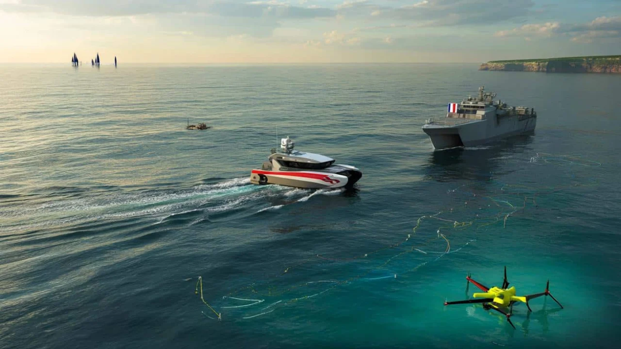
Modern ocean mapping bears little resemblance to the lead-line soundings of the 18th century. Today’s French hydrographic service employs cutting-edge technology:
- Multibeam sonar systems that can map thousands of square kilometers in a single survey
- Autonomous underwater vehicles that collect data in dangerous or remote areas
- Satellite altimetry for monitoring sea level changes in real-time
- Artificial intelligence for processing massive datasets and identifying patterns
But technology is only part of the story. The French hydrographic service has something that newer organizations lack: institutional memory. Three centuries of accumulated knowledge about ocean patterns, seasonal variations, and long-term trends provide context that no amount of modern technology can replace.
“We have tide measurements going back to the 1700s,” notes veteran SHOM cartographer Michel Rousseau. “That historical perspective is invaluable when you’re trying to understand whether current changes are normal variation or something unprecedented.”
FAQs
What exactly does the French hydrographic service do?
SHOM maps ocean depths, identifies underwater hazards, tracks sea level changes, and provides navigation data for both military and civilian vessels worldwide.
How is France’s maritime territory so large?
France controls waters around numerous overseas territories including French Polynesia, New Caledonia, French Guiana, and islands in the Indian Ocean, giving them the world’s second-largest maritime domain.
Why does ocean mapping still matter in the age of GPS?
GPS tells you where you are on the surface, but ships need to know what’s underneath – water depth, underwater obstacles, and current patterns that GPS can’t provide.
How does SHOM compare to other countries’ hydrographic services?
While the UK and US have larger, more well-known services, SHOM is the world’s oldest continuously operating hydrographic organization and covers the second-largest maritime area globally.
What’s the economic value of accurate ocean mapping?
Maritime commerce worth trillions of dollars annually depends on accurate charts, while emerging industries like offshore wind and deep-sea mining require detailed seabed maps to operate safely.
How has climate change affected SHOM’s work?
Rising sea levels, changing storm patterns, and new Arctic shipping routes have expanded SHOM’s mission to include climate monitoring and helping coastal communities adapt to changing conditions.